|
A PHOTOGRAPHY VERY WELL TAKEN AND VERY CURIOUS:
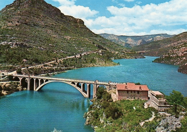
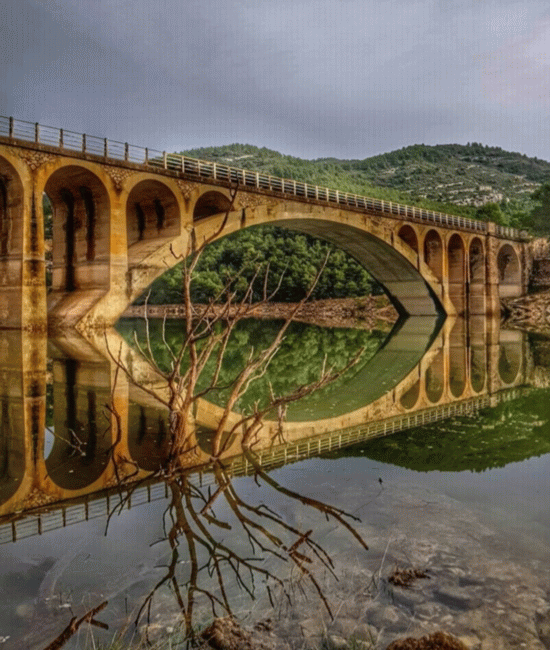
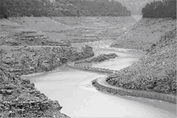
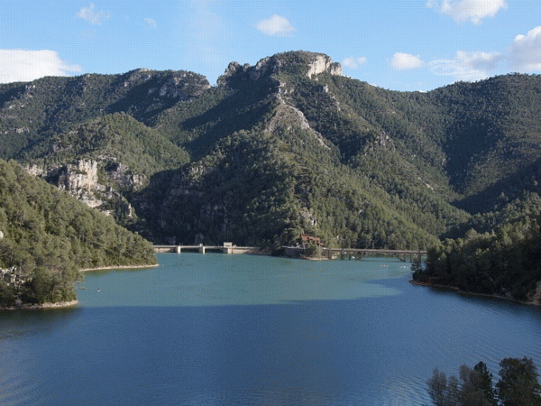
THE SWAMP IN DROUGHT TIME:
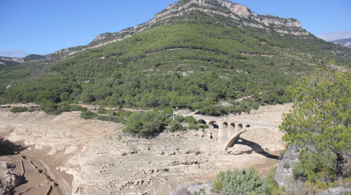
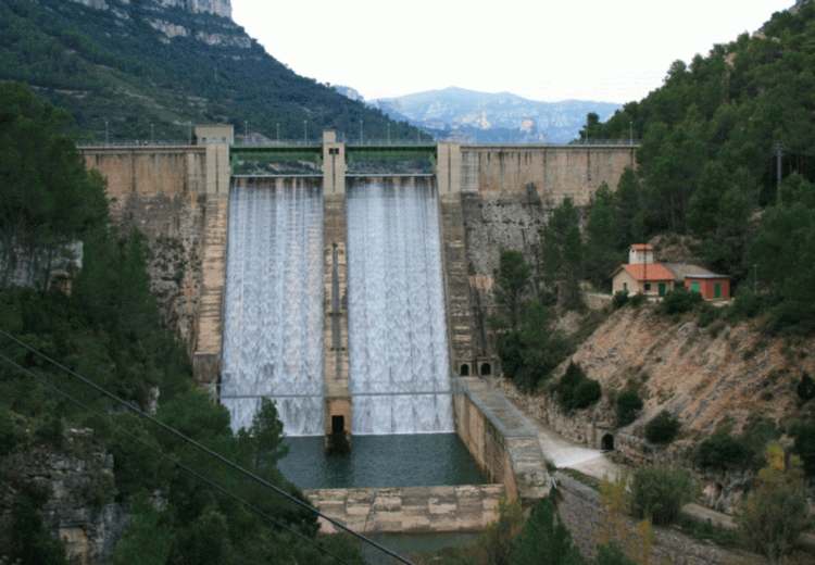
A FRONT VIEW OF THE DAM,
TO DISTINGUISH THE HEIGHT:

The Swamp of Ulldecona (La Senia) is located at the municipal end of the Pobla de Benifassà, in the region of Baix Maestrat, the Valencian Country.
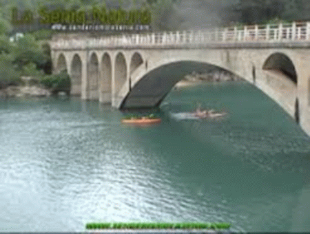
You are the confluence of three ravines, the ravine of the Fou of Teulatí (or of the Tenalla) and the ravine of the Pobla. It was built in 1967, financed by the payers of Ulldecona (which gives the name) to the river of the Sénia river, in the territory of the Hydrographic Confederation of Xúquer, occupying an area of 817 ha and with a capacity of 11 Hm³. The dam is gravity. The dam is 54 m high and 180 m wide. This reservoir belongs to the Confederación Hidrogràfica del Xúquer. In summer, spring and autumn the Ulldecona reservoir is a tourist place. There is accommodation and restaurant and you can rent pedal boats and boats to enjoy the views of the lake and the calcareous mountains that surround it.
THE SWAMP IN SEQUER TEMPS:
THE SWAMP IN SEQUERA TEMPS, TOT I MONTH SEC
GENERAL DATA OF THE PREY
Name of the dam: SÉNIA Type of dam: Gravity
Other Name: Height from foundations (m): 61,000
In phase of: Exploitation Coronation length (m): 167,000
Owner of the dam: STATEMENT Coronation level (m): 479,830
Designer: L. BERMEJO, E. MILLARES, J. SANCHO Foundations (m): 418,830
Risk category: A Level of flow (m): 429,330
End of works: 01-01-1967 Volume body prey (1000 m3): 129,000
Recreation: 01-01-1984 Number of drains: 001
Coordinates UTM 30: 0773861 - 4507456 Drainage capacity (m3 / s) 47,000
Uses of the dam: Irrigation - - Nº of spillways: 001
Users: - - Spillways capacity (m3 / s): 400,000
Regulation: Gates. -
HYDROLOGICAL DATA
Basin area (km2): 126,000 GEOGRAPHICAL DATA
Average annual contribution (hm3): 37,600 Rio de localização location SÉNIA
Average annual precipitation (mm): 785,800 Municipality: LA PUEBLA DE BENIFASAR.
Avenue of Project (m3 / s): 167,000 Shed:JÚCAR
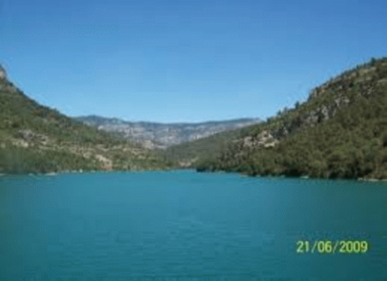
The swamp full
The swamp fuller still:
The fullest swamp The day 29-11-18:

Clicking on the bird goes to the home page

|
©
Copyright Antonio Torres Chaure 1998 = Latest Update 2022. Legal warning |
|

 Castellà: